Grounding Line Location
The grounding line location (GLL) marks the position of where a marine terminating glacier starts to float. Understanding the processes at the grounding line of outlet glaciers is important in order to predict the response of the ice to changing boundary conditions and to establish realistic future scenarios in response to climate change.

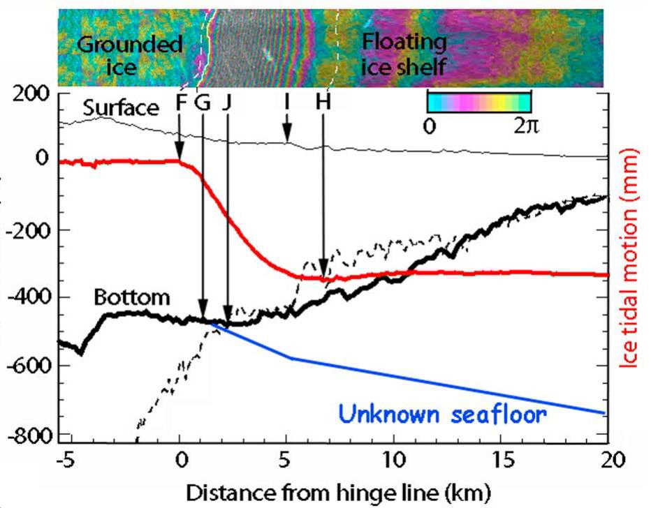
Remote sensing observations do not provide direct measurements of the grounding line position but can be used to detect the tidal flexure zone, using InSAR data, or spatial changes in texture and shading, using optical images, which are indicators of the transition from grounded to floating ice. Due to the plasticity of ice these indicators usually spread out over a zone upstream and downstream of the actual grounding line also called the grounding zone.
In the Greenland Ice Sheet CCI the grounding line location is derived from InSAR data by mapping the tidal flexure zone visible in interferograms. It is generated for selected glaciers with a floating ice tongue.
Click here to browse and download Grounding Line Location products
Products by ENVEO are also available directly from http://cryoportal.enveo.at/.

![Science [&] Technology](/sites/default/files/documents/admin/Partner Logos/st_logo.jpg)


