


Supraglacial Lakes
Submitted by Daniele Fantin on Sun, 2020-04-26 20:07


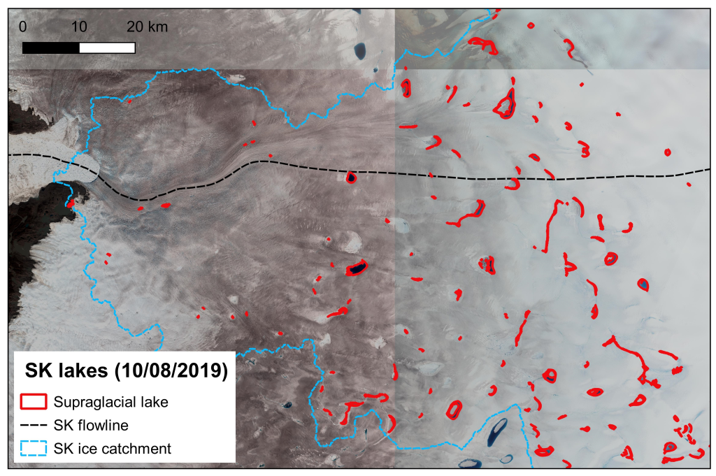
Supraglacial Lakes (SGL) are meltwater lakes that form in depressions at the surface of the ice sheet in the ablation zone. Supraglacial lakes are indicators of surface melt, and are a major component of routing and storage of meltwater at the ice sheet surface. These play an important role in the delivery of meltwater to the base of the ice sheet. The delivery of water to the base of glaciers and ice sheets has been observed to influence basal sliding on a range of spatio-temporal scales, as well as play a pivotal role in the seasonal evolution of the subglacial drainage system.
The SGLs are derived from Sentinel-2 optical data using an automated Normalised Difference Water Index (NDWI). These products are produced for selected regions of interest, and version 1.1 is for the Sermeq Kujalleq (Jakobshavn Isbrae) hydrological catchment, as defined by Mankoff et al. 2020. The lake outlines are stored as standard vectorised polygons, with additional metadata stored in the attribute table. The detected lakes are filtered according to maximum recorded surface area and a mask of SGL basins from DEM sink filling is applied to remove false positives.
A more detailed description of the product, including analysis of elevation and individual lakes, is available in the product report.
Click here to browse and download SupraGlacial Lakes products.
The product is a R&D CCI+ activity and it is generated by Asiaq (Greenland).
